Bwlchgwallter and Hafod Forest Resource Plan
Location and setting
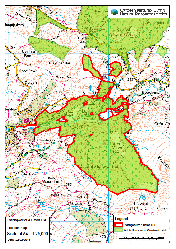
The Bwlchgwallter and Hafod forests are situated in the Ystwyth valley, to the south-east of Aberystwyth, traditionally (in previous plans) these forests have been split into two separate plans. Now we have recognised it as one single forest area of 593 hectares (See map below).
The forests are within the Ceredigion County Council Planning Authority. Hafod forest is highly visible and much it is a designated Historic Park and Garden and is managed in partnership with the Hafod Trust. The lower northern slopes of Bwlchgwallter forest are also highly visible and designated, however the majority of the forest is less visible.
These are moderately productive forests for timber; soils and climate are good at lower elevations and poorer at higher elevations but are mostly suitable for growing a wide variety of tree species. The forest is predominantly spruce but also pine, fir and larch. To date there has only been a limited impact of Phytophthora ramorum on larch in the area, but it is accepted that this species will need to be removed in the coming years as part of the larch replacement programme currently being implemented.
Ancient woodland is designated over approximately 153 hectares of the plan area in varying ecological condition from Ancient Semi-Natural Woodland (ASNW), to significant areas of Plantation on Ancient Woodland Sites (PAWS) with few remnant features. To the south-east of the forests is the Elenydd SPA, SAC and SSSI. This large upland site also covers Bwlchgwallter forest, approximately 422 hectares of the SPA and SSSI is within the forest boundary. To the north-west of the plan area are Cae’r Meirch SSSI and Gro Ystwyth SSSI.
There are a number of archaeological features designated as Scheduled Ancient Monuments, as well as other natural and man-made structures of historical importance, in relation to the Johnesian paths, that contribute to the “Picturesque” qualities of Hafod and the surrounding landscape. There are also numerous remnant agricultural and industrial features such as farmsteads, walls and levels throughout the forest.
There are failing water catchments (moderate status under the Water Framework Directive) that include the forests, particularly for acidification. There has been a history of riparian and reservoir boundary improvement over the past 15 to 20 years, removing conifer and improving habitats, though further work is still required.
The highly exposed nature of the upper parts of Bwlchgwallter forest provides some challenges to management, much of the forest is marginal for LISS management potential due to windiness and soils though the majority of Hafod has good potential for LISS. Recent wind blow in a number of crops will require early attention.
Hafod and the lower elevations of Bwlchgwallter – around the grotto, Bwlchgwallter Falls, Dologau – have medium (to high in peak season) recreational usage. There are a number of promoted Public Rights of Way (via Ceredigion County Council) running through the forest which connect the forest to nearby communities and longer distance routes. There are also a variety of additional, promoted, Natural Resources Wales signposted permissive paths and trails catering for a variety of recreational activities including walking, running, cycling, and horse riding. Just under a half of all visitors to the forest are tourists. Areas around Dologau and Pont Melin are promoted for wild swimming (Wild Swimming Wales book).
Location map
Summary of objectives
- Managing for water – continued improvement of riverine habitat, including the gradual reduction of the need for forest harvesting operations in many of the steep difficult terrains associated with these water courses. Establishing a framework of predominantly native habitat, linking existing ancient woodland, helping to improving water quality and reducing the risk of forest operations impacting on water sedimentation.
- Maintaining timber production - Parts of the plan area are productive timber forests with high yielding crops. There is potential for diversification across the plan area and it will remain a priority to maintain this productivity but ensuring both structural and species diversity are introduced.
- Management systems on exposed sites and steep terrain which limits opportunities for forest management should be appropriate to the site and promote good silvicultural management practices.
- Much of Bwlchgwallter forest is second rotation conifer crops with large areas approaching first thinning interventions that will support the development of LISSs, reduce the need for large scale clearfelling in the future and aid the development of structural diversity of the forest.
- Key habitats, such as open and lower density areas adjacent to the SSSI and SAC and riparian areas, should be protected and enhanced.
- Forest management should be sensitive to the historic setting of the forest and the increasing potential for public access and recreational use of the forest. This will link with other objectives and may include diversification of the forest and native and amenity plantings, where silviculturally appropriate.
Maps
Long term primary objectives map
Indicative forest types and habitat map
10 year management objectives map
10 year harvesting activities map
If you have any comments or feedback, you can contact the Forest Resource Planning team at frp@naturalresourceswales.gov.uk